becker County
ponsford


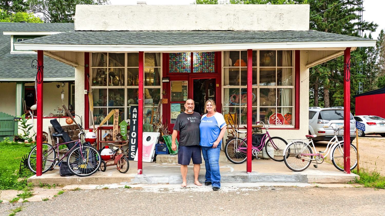
Ponsford, MN. Edie (photo above) grew up in nearby Pine Point and returned about six or seven years ago. She shared memories of Ponsford when it was once bustling with shops and businesses along Highway 44. After Highway 34 was built, most of the businesses disappeared, and today only a few original buildings remain, including the old post office and gas station pictured above. Now retired, Edie is working on community projects, including a History & Healing project exhibited in Pine Point’s community center. Featured above is Edie, and also included in the photos is John, her son’s friend, who was out working in the yard when I visited.
More photos and info coming soon.
pine point


Pine Point–The name Ne-zhingwaakokaag translates to “place of the white pines,” a reference to the tall white pine trees that once defined this point of land.
While I was there I visited Bam’idzowigamig Creator’s Place and met artists David, Erica, Bridget, Heather, Amy, and Alisha, who shared their creative processes and beautiful artwork. All of their work is available for purchase at the Creator’s Place, on Etsy, and at Carters Red Wagon in Park Rapids, MN.
I also visited the Pine Point Community Center, where Edie Smith’s exhibit shares the history and lived experiences of the area — a beautiful and thoughtfully curated space worth seeing.. I also visited the Pine Point Community Center, where Edie Smith’s exhibit showcases the history and stories of the area—a beautiful space well worth seeing.
Note: Check out the Creator's Space and artists work HERE
More photos and info coming soon.
snellman


snellman: 46°53′22″N 95°24′47″W
Est: late 1880's
pop: unknown
Township: osage
township pop: 774
Notes: Snellman, sits right off Highway 34, about halfway between Detroit Lakes and Park Rapids. It’s a quiet, rural community with roots you can feel—though I’d love to learn more about its history!
Here's a fun article I found about Snellman go HERE
two inlets


two inlets : 47°1′41″N 95°12′30″W
est: 1891
pop: I am guessing a handful
Township: two inlets
township pop: 208
Notes: Nestled along Highway 44, Two Inlets is a small town with a big heart. The Country Store is the community hub, serving as a restaurant, bar, and convenience stop, with gas available around the clock. Robb Peterson, who has been coming here since he was a child, shared memories of growing up visiting the area and helped bring its past into view by remodeling the store and uncovering historic photos once tucked away in storage.
Also featured in the photos are Bob and Cindy Hanson, who run the Junquemonger Antique Shop just off the town’s main street. St. Mary’s Catholic Church and Grotto, first built in the early 1900s and rebuilt after fires, rounds out the town center, reflecting the deep roots and pride of the Two Inlets community.
richwood


tansem: 46°40′31″N 96°14′10″W
Est: late 1800's
pop: unknown
Township pop: 222
Township: tansem
Notes: Tansem Township was named for John O. Tansem, a Norwegian immigrant and pioneer farmer.
rochert


rochert: 46°51′36″N 95°41′16″W
Est: late 1800's
Town pop: unknown
Township pop: 546
Township: holmesville
Notes: Rochert traces its beginnings to Palm Peter and Nikolaus Heuters, who came to the area after emigrating from Rocherath, Belgium. Early community life included a log schoolhouse in the late 1800s, with a larger school built around 1901. A general store followed in 1917, helping shape Rochert as a small but active rural crossroads.
osage


osage: 46°55′13″N 95°15′25″W
Established: 1891
Town pop: 226–282
Township: osage
township pop: 774
Notes: I spent an afternoon visiting with Christy Byer, who grew up here and now owns the grocery store with her husband. She shared how the consolidation of the local school, which happened years ago, had a lasting impact on the town. The school was once a central gathering place, and its absence changed how people connected day to day. Even so, Osage continues to hold onto a strong sense of pride and familiarity, with a community spirit that’s easy to feel.
For those interested in Osage’s early logging history, a locally made book tracing the town’s past is available at the grocery store.
midway


midway: 46°46′55″N 95°15′37″W
Established: mid 1850's
Town pop: est 10
township: runeberg
township pop: 623
Notes: Midway is a quiet, peaceful town. Dorothy, who owns Huntersville Outfitters Canoe, remembered when the Horsefly baseball team played at the Outpost in Huntersville before relocating to Midway within the past decade.
Information on this page sourced from Wikipedia and oral history.